
The Dike: What’s at Stake
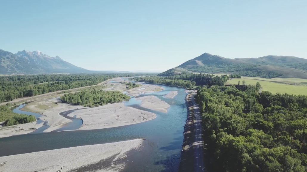
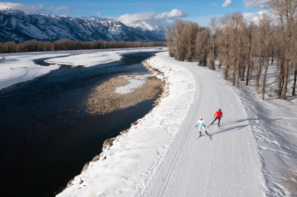
The ever popular Wilson dike, forest, and river bottom of BLM Parcel 9/10 make up 400+ acres of public land upstream of Emily Stevens Park. This is one of the most important public access points along the Snake River. It is also where the future of Snake River public lands is being decided.
Take Action
Your voice is needed NOW to ensure we keep public lands in public hands. Please write to Commissioners Today!
Teton County Commissioners are actively determining the long-term vision for the future of Public Lands north of Emily Steven’s Park. “The Dike” as we know it, is actually 400+ acres of BLM land officially know as Parcels 9/10. It includes the levee top, river bottom to the west, and high-value recreation, cottonwood forest and wildlife habitat to the east. Right now, decision being made about this land could change when, how, and whether the public can use it – including impacts to everyday public access.
Tell the Teton County Board of County Commissioners:
- Keep Parcel 9/10 open and accessible
- Maintain existing uses
- Ensure decisions are made through a transparent public process
- Cement Teton County management authority
- Keep public lands in public hands
Be sure to share your personal experiences and the kinds of access you value with commissioners.
📧 commissioners@tetoncountywy.gov
Send a quick email (2-3 sentences is enough).
Subject: Keep Parcel 9/10 Public
Example: I value access to Parcel 9/10 for [your uses]. Please keep the entirety of the parcel open, accessible, and managed through a transparent public process.
Why It Matters
If you’ve ever fished these waters, or walked, biked, and skied the levee top, or simply value open space and public lands – this decision affects you!
Parcel 9/10 is:
- One of the most heavily used recreation areas along the Snake River
- A critical wildlife habitat corridor
- A place where multiple uses currently coexist, including:
- Walking and wildlife viewing
- Fishing, hunting, and river access
- Biking and cross-country skiing
Today, under BLM management, these uses are broadly allowed and shaped through public process. However, this 400 acre parcel was identified over 20 years ago for transfer of ownership due to its isolated nature and distance from BLM field offices for effective management. You can find more detailed documents about this process below, under the More Resources heading.
Today:
- Open access
- Multiple uses
- Public management
Proposed:
- Restricted hours
- Limited uses
- Privately influenced management
What’s Being Proposed
Teton County can become the new landowner by one of two processes:
- Legislative Transfer: A process in which only three parties agree to the terms of the transfer: 4W Ranch (a leaseholder on Parcel 9/10), Teton County, and the Jackson Hole Land Trust.
- Recreation and Public Purposes Act: A process in which YOU (the public) will perpetually have a say in how the Parcel is managed.
A legislative transfer proposal from the adjacent landowner (4W/Walton Ranch) includes conditions that would change how this public land is used and managed.
Some elements of the proposal would:
- Limit public access to daylight hours only
- Restrict or effectively eliminate certain uses, including:
- Hunting
- Camping
- E-Biking
- Any recreating at dawn or dusk.
- Establish management structures that give a single adjacent landowner significant influence over future decisions
A Bad Trade for the Public
In exchange for management authority, 4W offers:
- A reduced grazing lease
- An easement along Highway 22 for a bike path
In effect, 4W is seeking management authority and reduced public access to over 400 acres of public land, in exchange for a few linear acres of bike path easement and securing grazing rights on public lands in perpetuity.
The Snake River Fund is in no way against a functional pathway for the community. However, we refuse to let one individual make the public choose between that pathway and public land access.
A Question of Public vs. Private Influence
At its core, this is about more than Parcel 9/10.
It’s about who decides how public land is managed
- Should decisions be made through public process and local government?
- Or should a single adjacent landowner shape those decisions?
The outcome here could set a precedent for how other public lands are managed in the future.
What We’re Advocating For
The Snake River Fund supports a path forward that:
- Keeps Parcel 9/10 in public ownership
- Maintains existing public access and uses
- Protects wildlife habitat and open space
- Ensures management decisions are made through public process
- Avoids setting precedent for private influence over public lands
