
Join SRF in the Fight to Keep Public Lands in Public Hands
For more than 20 years, local and regional stakeholders have worked towards a shared goal:
Transfer Snake River public land parcels out of federal ownership while keeping them public, accessible, and protected.
Today, we are closer than ever to achieving that goal. But key decisions being made right now will determine whether that vision is fully realized – or fundamentally altered.
Why It Matters
These riparian parcels:
- Provide incredible public access opportunities
- Support critical wildlife habitat
- Preserve open space in a rapidly changing landscape
- Reflect a long-standing community-drive vision for public lands.
The History
2004 — Federal Decision
After a multi-year public process, the Bureau of Land Management (BLM) adopted a plan to:
- Transfer parcels out of federal ownership
- Keep them in public ownership
- Ensure:
- Public access
- Wildlife habitat protection
- Open space preservation
2008 — Stakeholder Plan Created
A coalition of partners — including Teton County, the Snake River Fund, and others — developed a Snake River Corridor Transfer Plan that:
- Recommended transferring parcels to entities like Teton County
- Called for conservation easements
- Emphasized continued public access and habitat protection
- Envisioned a connected system of public lands along the Snake River
2008–2020 — Slow Progress
- Some parcels were successfully transferred through Administrative processes
- Others stalled due to complexity and competing interests
2020 — Teton County Takes the Lead
Teton County began actively pursuing completion of the remaining transfers:
- Strong community support remained
- Momentum increased to finish what had been started
Today — Key Decisions Ahead
Most parcels are moving forward.
However, Parcel 9/10 (near Emily Stevens Park) has become a central point of debate — not over whether it should be public, but how it should be managed once transferred.
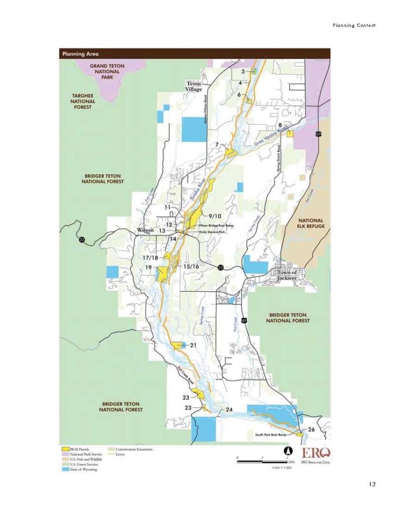
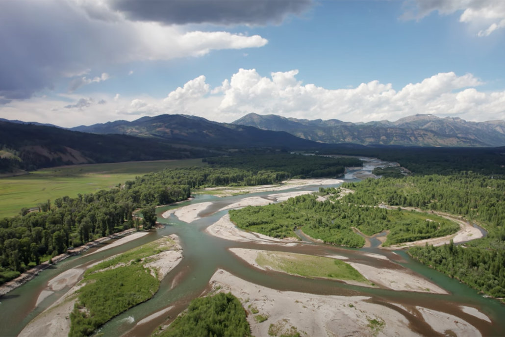
The Snake River Public Parcels stretch along approximately 20 miles of the Snake River and represent some of the most important riparian habitat and recreation access points in Teton County.
The location of all of these parcels can be explored using THIS MAP TOOL.
The Current Issue
For Parcel 9/10, the process has slowed due to disagreement over future management.
Some proposed transfer agreements include conditions that would:
- Restrict when the public can access the land
- Limit certain recreational uses currently allowed today
- Introduce significant influence from a single adjacent landowner over future management decisions
The Bottom Line
- 4W is seeking management control over 400+ acres of public land in exchange for a pathway easement along Highway 22.

